Neighbourhood Guide

King West
Walkability & Transit

Toronto's loft and condo district west of Spadina, with King streetcars at the door and the Financial District minutes away. Explore TTC routes, nearby amenities, cycling and commute times.

100
Walk Score
100
Transit Score
99
Bike Score

Understanding Your Scores

Walk Score rates central King West a perfect 100 for walking and transit, with near-perfect bikeability.

100/100

Walk Score

Walker's Paradise

Daily errands do not require a car. Groceries, restaurants, cafés, gyms and parks are all a short walk along King, Queen and Portland streets.

100/100

Transit Score

Rider's Paradise

World-class public transportation. The 504 King streetcar runs right through the neighbourhood, with the 501 Queen, 510 Spadina and 511 Bathurst close by.

99/100

Bike Score

Biker's Paradise

Flat streets and protected bike lanes on Richmond and Adelaide make cycling downtown fast and easy.

Scores for 560 King St W in King West from Walk Score®. Scores can change as Walk Score updates its data.

TTC Network

Transit Routes & Accessibility

King West sits on the King Street transit priority corridor, with frequent streetcars and quick links to Line 1 and Union Station.

7 RoutesAll Types
Frequent service on the King Street transit priority corridor, connecting to St. Andrew and King stations on Line 1. Branches run west to Dundas West Station and Dufferin Gate and east to the Distillery District and Broadview Station. Overnight service runs as the 304 King.
Runs east–west along Queen Street across downtown, connecting to Osgoode and Queen stations on Line 1. Overnight service runs as the 301 Queen.
Runs in its own right-of-way between Spadina Station (Lines 1 and 2) and Union Station via Queens Quay. Overnight service runs as the 310 Spadina.
Runs north–south on Bathurst Street between Bathurst Station (Line 2) and Exhibition Place. Buses may replace streetcars during track work.
Connects Liberty Village with Ossington Station (Line 2) and Eglinton West Station. Overnight service runs as the 363 Ossington.
St. Andrew Station at King St W and University Ave is a short ride east on the 504 King streetcar. Osgoode Station at Queen and University is on the 501.
Union Station is about 15 minutes away by streetcar and subway, with GO Transit trains and the UP Express to Pearson Airport (about 25 minutes).
St. Andrew StationLine 1 Yonge–University at King St W and University Ave, a quick ride east on the 504.
Spadina & Bathurst StationsLine 2 Bloor–Danforth, reached on the 510 Spadina or 511 Bathurst from the edges of the neighbourhood.
Ontario Line (under construction)King–Bathurst and Queen–Spadina stations are planned right next to King West.

Route information from the TTC. Check ttc.ca for current schedules and service changes.

What's Nearby

Grocery stores, restaurants, parks and some of Toronto's best entertainment are all a short walk from King West.

Loblaws585 Queen St W (at Portland St)
6 min
Sobeys Urban Fresh22 Fort York Blvd
15 min
Metro100 Lynn Williams St, Liberty Village
20 min
King Street WestRestaurants, bars and cafés along the strip
1 min
Queen Street WestCafés, shops and restaurants
5 min
Ossington AvenueRestaurants and bars north of Queen
18 min
Victoria Memorial SquareWellington St W at Portland St
4 min
Clarence SquareSpadina Ave at Wellington St W
6 min
Trinity Bellwoods Park790 Queen St W
15 min
Queen Street West shopsQueen St W, Spadina to Bathurst
5 min
Kensington MarketNorth of Dundas St W at Spadina
20 min
CF Toronto Eaton Centre220 Yonge St (on the 501)
30 min
Toronto Western Hospital399 Bathurst St
15 min
Fitness studiosGyms and studios along King St W
2 min
St. Michael's Hospital30 Bond St (on the 504)
35 min
TIFF Lightbox350 King St W
12 min
Princess of Wales Theatre300 King St W
13 min
Rogers Centre1 Blue Jays Way
18 min

Approximate walking times from King St W at Portland St.

Walking Time Radius

See what you can reach on foot from the heart of King West

Walking Distance Map

5 min Walk
  • Victoria Memorial Square
  • Clarence Square
  • Loblaws at Queen & Portland
  • 504 King streetcar stops
  • Restaurants on King St W
  • Queen Street West shops
10 min Walk
  • TIFF Lightbox
  • Princess of Wales Theatre
  • Queen St W at Spadina
  • 510 Spadina streetcar
  • Fort York National Historic Site
  • Toronto Western Hospital
15–20 min Walk
  • Rogers Centre
  • CN Tower
  • Trinity Bellwoods Park
  • Kensington Market
  • Liberty Village
  • Roy Thomson Hall
Cycling

Bike Infrastructure

King West has some of the best cycling access in Toronto, with protected lanes on Richmond and Adelaide and Bike Share stations on nearly every block.

99Bike Score® · Biker's Paradise

Protected Bike LanesNearby

Separated cycle tracks on Richmond St W and Adelaide St W run east–west across downtown.

Bike Share TorontoDocking stations

Bike Share Toronto stations throughout King West make one-way trips easy without owning a bike.

Flat Street GridEasy riding

Mostly flat streets make quick trips to the Financial District, Liberty Village and Queen West simple.

Trail AccessRecreation

The Martin Goodman Trail on the waterfront is about 1.5 km south, past Fort York.

99Bike Score
~1.5 kmto the waterfront trail
Flatstreet grid
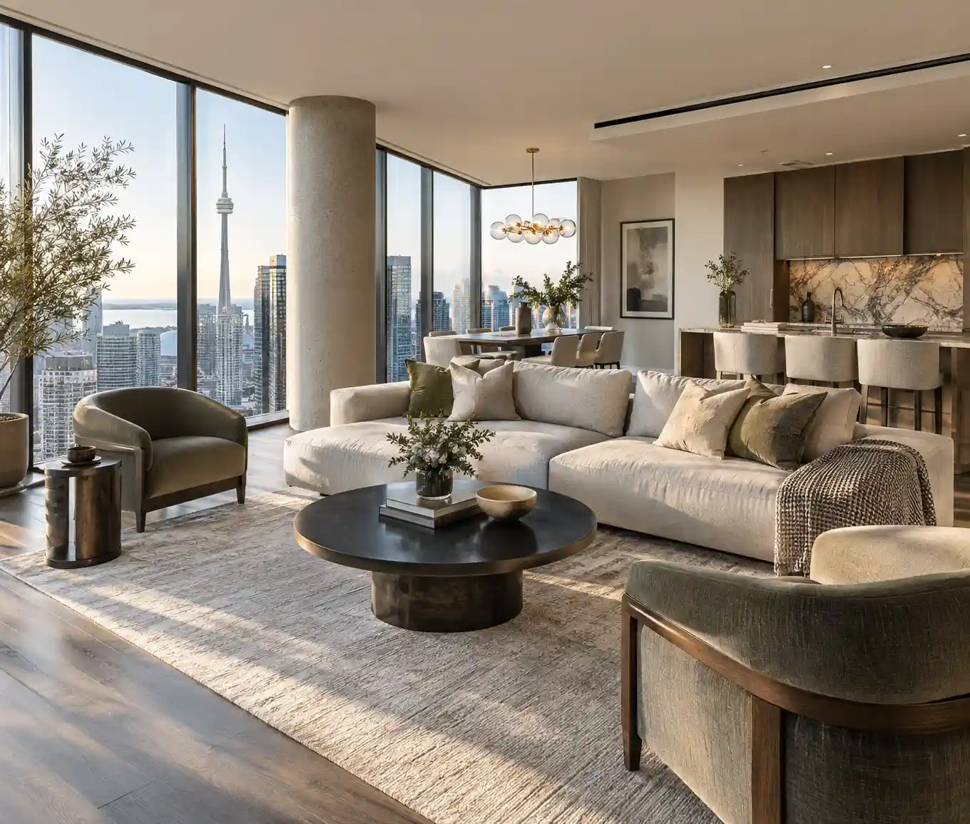
King West neighbourhood in Toronto
Quick Fact

The Financial District is about a 10-minute ride from King West, often as quick as the streetcar at rush hour.

Key Cycling Routes

Richmond & AdelaideProtected lanesEast–west cycle tracks across downtown.
Garrison CrossingBridgesBike and pedestrian bridges linking Fort York with the Strachan Ave area.
Martin Goodman TrailWaterfrontToronto's lakeshore trail, about 1.5 km south.
Portland & Niagara StreetsLocal streetsQuieter north–south and east–west connections through the neighbourhood.

Bike Score® from walkscore.com. Ride and walk times are approximate.

Commute Times

Approximate travel times from King West to popular Toronto destinations

DestinationTransitDriveBikeWalkBest Route
Financial District≈ 10 min≈ 8 min≈ 7 min≈ 25 min504 King streetcar
Union Station≈ 15 min≈ 10 min≈ 9 min≈ 30 min504 King to Line 1
CF Toronto Eaton Centre≈ 20 min≈ 12 min≈ 10 min≈ 35 min501 Queen streetcar
Liberty Village≈ 10 min≈ 6 min≈ 6 min≈ 20 min504 King streetcar
Kensington Market≈ 15 min≈ 8 min≈ 7 min≈ 20 min510 Spadina streetcar
St. Lawrence Market≈ 20 min≈ 12 min≈ 12 min≈ 40 min504 King streetcar
Distillery District≈ 30 min≈ 15 min≈ 15 min—504 King streetcar
Yorkville≈ 25 min≈ 15 min≈ 15 min—510 Spadina to Line 2
High Park≈ 30 min≈ 15 min≈ 20 min—504 King to Roncesvalles
Midtown (Yonge & Eglinton)≈ 35 min≈ 25 min≈ 30 min—504 King to Line 1 north
Pearson Airport≈ 45 min≈ 30 min——To Union, then UP Express

Off-peak estimates from King St W at Portland St. Times vary with traffic and service; check ttc.ca for current schedules.

Car-Free Living in King West

  • The 504 King streetcar runs on the King Street transit priority corridor through the neighbourhood
  • Four streetcar routes (504, 501, 510 and 511) serve the neighbourhood and its edges
  • Groceries, gyms, restaurants and parks are all a short walk away
  • Protected bike lanes on Richmond and Adelaide, plus Bike Share stations on most blocks
  • The future Ontario Line will add King–Bathurst and Queen–Spadina stations nearby

Ready to Live in King West?

Browse King West condos for sale or talk to our team about buying in the neighbourhood.